Patagonia stretches across nearly one million square kilometers of southern Argentina and Chile, and no two corners of it look alike. Glaciers calve into turquoise lakes, granite spires pierce the clouds, and windswept steppe gives way to temperate rainforest within a few hours’ drive.
The region rewards travelers who take time to understand its geography before setting out. Here are ten landscapes that capture what makes Patagonia unlike anywhere else on earth.
Torres del Paine’s Granite Towers
The three granite towers that give Torres del Paine National Park its name rise nearly 2,850 meters straight out of the Patagonian steppe. Formed by cooling magma some 12 million years ago, they’ve since been exposed by glacial erosion that stripped away the softer sedimentary rock around them.
Sunrise turns the towers a deep orange-pink, a moment photographers plan entire itineraries around. The base trek to see them up close takes about eight to ten hours round trip.
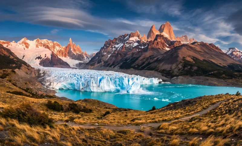
Perito Moreno Glacier
Unlike most glaciers worldwide, Perito Moreno is advancing rather than retreating, calving chunks of ice the size of apartment buildings into Lake Argentino. It spans 250 square kilometers and stands roughly 74 meters tall at its face.
Walkways near El Calafate let visitors watch and hear the ice crack without needing technical climbing gear. Guided ice treks on its surface are also available for those who want to walk directly on the glacier.
Fitz Roy Massif
Near the town of El Chaltén, the jagged peaks of Fitz Roy and Cerro Torre form one of the most photographed skylines in South America. Local winds are so notoriously strong that early climbers waited weeks for a clear window to attempt a summit.
The Laguna de los Tres trail offers the classic view of Fitz Roy reflected in a glacial lake, a hike of about 20 kilometers round trip. Weather here changes fast, so layered clothing is non-negotiable.
Valdes Peninsula
This flat, arid peninsula on Argentina’s Atlantic coast doesn’t look dramatic from inland, but its coastline hosts some of the richest marine wildlife on the continent. Southern right whales gather in the sheltered bays between June and December to breed and calve.
Orcas are known to intentionally strand themselves on beaches here to hunt sea lion pups, a behavior documented almost nowhere else. Magellanic penguins and elephant seals round out a coastline that feels more like a wildlife reserve than a scenic overlook.
Marble Caves of Lake General Carrera
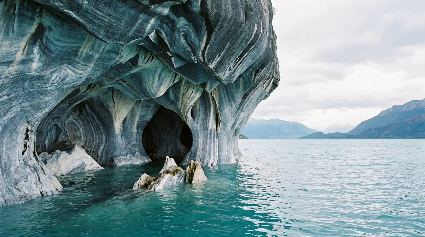
On the Chilean side of Patagonia, wind and water have carved swirling caverns into a peninsula of solid marble along Lake General Carrera. The lake’s mineral-rich glacial water gives it an almost unreal turquoise and cobalt color that shifts with the light and season.
Small boats or kayaks are the only way to reach the caves, since there’s no road access to the formations themselves. Visiting in the dry summer months, from December through February, gives the clearest water and the most vivid color.
Beagle Channel and Ushuaia
Ushuaia, often billed as the world’s southernmost city, sits on the edge of the Beagle Channel, a strait separating the main island of Tierra del Fuego from smaller islands to the south.
Boat excursions here pass sea lion colonies, cormorant rookeries, and a lighthouse often mistaken for the fabled “End of the World” beacon from Jules Verne. Snow-capped peaks rise directly from the water, giving the channel a fjord-like feel. It’s also the main departure point for cruises heading to Antarctica.
Nahuel Huapi and the Lake District
Around Bariloche, the landscape shifts entirely, trading steppe for dense forests of coihue and arrayán trees around Nahuel Huapi Lake. The lake covers over 500 square kilometers and is ringed by volcanic peaks, including the still-active Cerro Tronador.
Chocolate shops and alpine-style architecture in Bariloche reflect the wave of Swiss and German immigrants who settled the area in the early 20th century. Travelers building custom itineraries, including those booking Patagonia luxury tours, often use this region as a comfortable base for exploring nearby national parks.
The Patagonian Steppe
Much of Patagonia’s interior is flat, dry grassland, shaped by relentless westerly winds that can gust past 100 kilometers per hour. Guanacos and rheas are common sights grazing here, and the open horizon makes for some of the clearest stargazing in the Southern Hemisphere. Sheep estancias still dot this landscape, many now open to visitors for a look at traditional ranching life.
Tierra del Fuego National Park
At the southern tip of Argentina, Tierra del Fuego National Park mixes subantarctic forest, peat bogs, and coastal inlets along the Beagle Channel. It’s also the terminus of the famous Route 3, marked by a sign noting the distance back to Alaska.
Beavers introduced from Canada in the 1940s have reshaped parts of the landscape, an unplanned experiment in ecological disruption still visible in the flooded forests today.
Cerro Torre
Cerro Torre’s needle-thin summit, capped by a mushroom of ice formed by relentless wind, made it one of the last major peaks in the world to be reliably climbed.
Its sheer granite face and unpredictable weather have turned it into a benchmark of technical mountaineering difficulty. Even without climbing it, hikers can reach viewpoints near El Chaltén that frame the spire against turquoise glacial lakes.
Patagonia isn’t a single destination so much as a collection of extreme landscapes stitched together by long drives and short flights. Planning a route that connects two or three of these regions, rather than trying to see everything, tends to make for a far more satisfying trip.